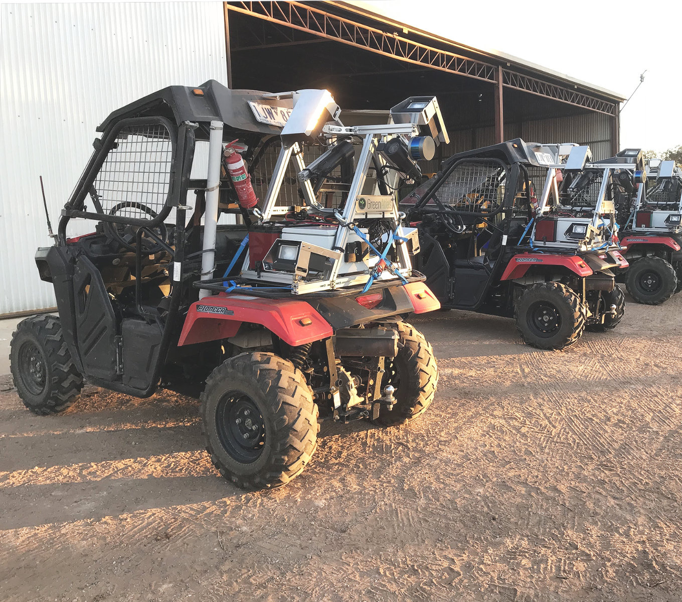
Cartographer
Effortless fruit counting.
Innovation to improve orchard outcomes.
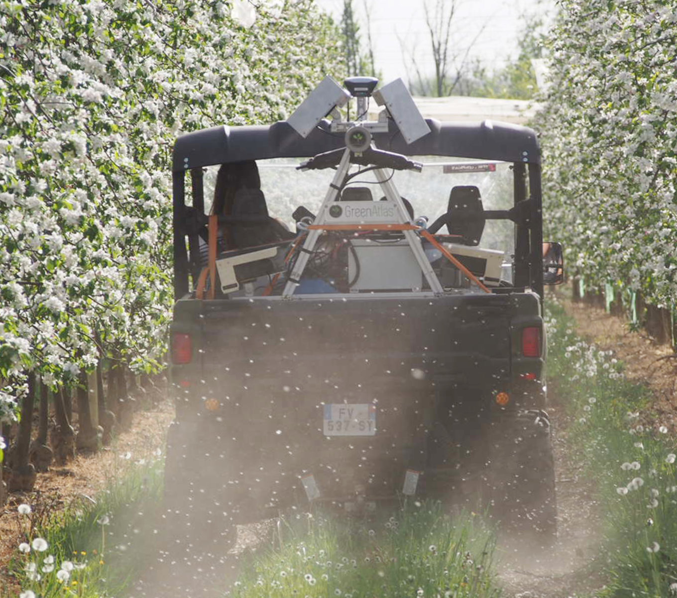
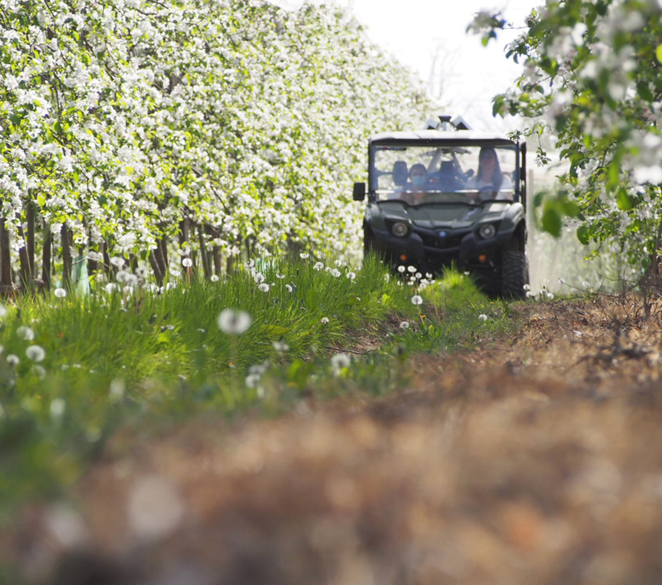
Green Atlas Cartographer is the innovative combination of hardware and software that allows flower and fruit counts to be quickly and accurately mapped over entire orchards.
With high resolution imaging and AI assisted mapping, our customers know every block and every tree, giving a clear advantage in managing the complete life cycle, from flower to fruit.
Cutting Edge Technology.
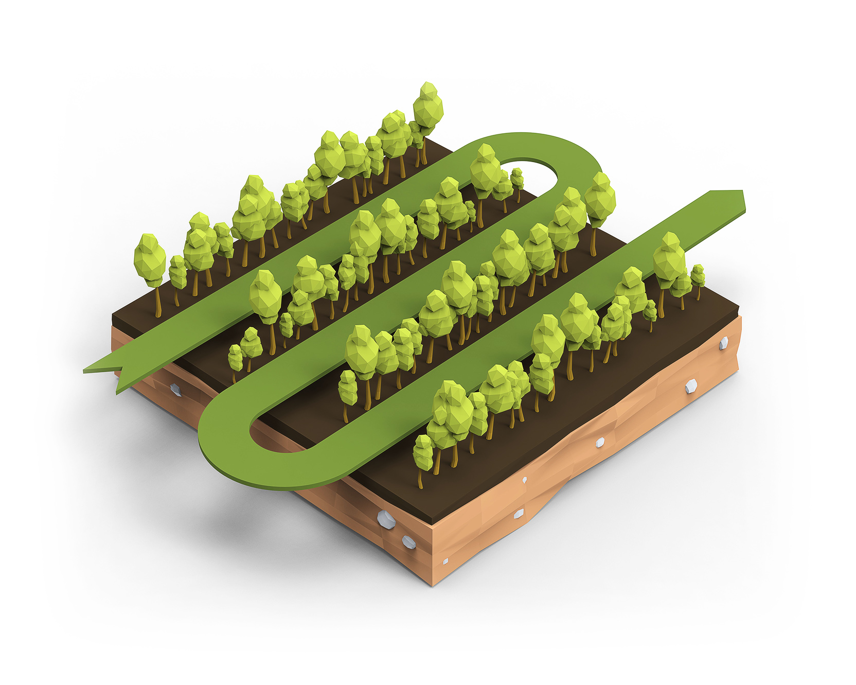
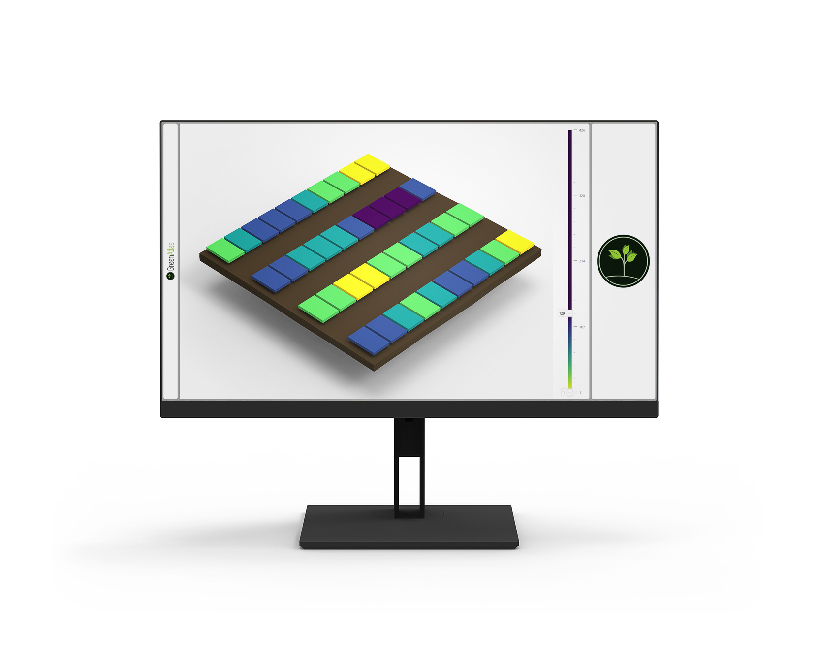
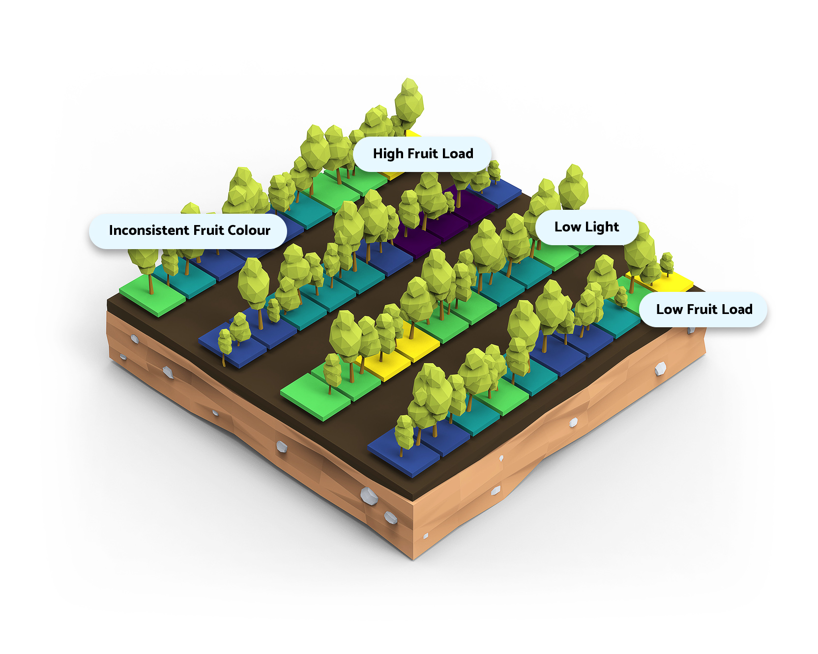
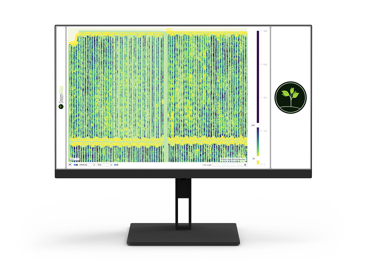
Mapping tree performance, across the entire orchard.
Quick and Accurate
Fast, repeatable performance
At 20km/h or more, Cartographer can scan whole blocks in the time it takes field crews to count only a handful of trees. Operating at ground level, Cartographer scans every fruit on every tree, giving unmatched data depth and accuracy.
AI and Machine Learning
Next generation technologies
Leveraging a decade of world-leading University research in the application of Artificial Intelligence and Machine Learning, Cartographer is highly automated.
Minimise errors from a lack of data and imprecise calculations, our platform collates all the information you need to improve orchard outcomes.
And we're continuously developing new insights that extend from the block to the orchard, to the pack-house, and beyond.
Simple. Minimal.
Up and running in minutes.
Easy to operate with minimal training and few personnel, the Cartographer can be up and running in minutes, collecting invaluable information about the state of your orchard.
Effortlessly perform scanning, benchmarking and analysis around the schedule of your current operations.
Configurable, modular design
Tailored to your needs
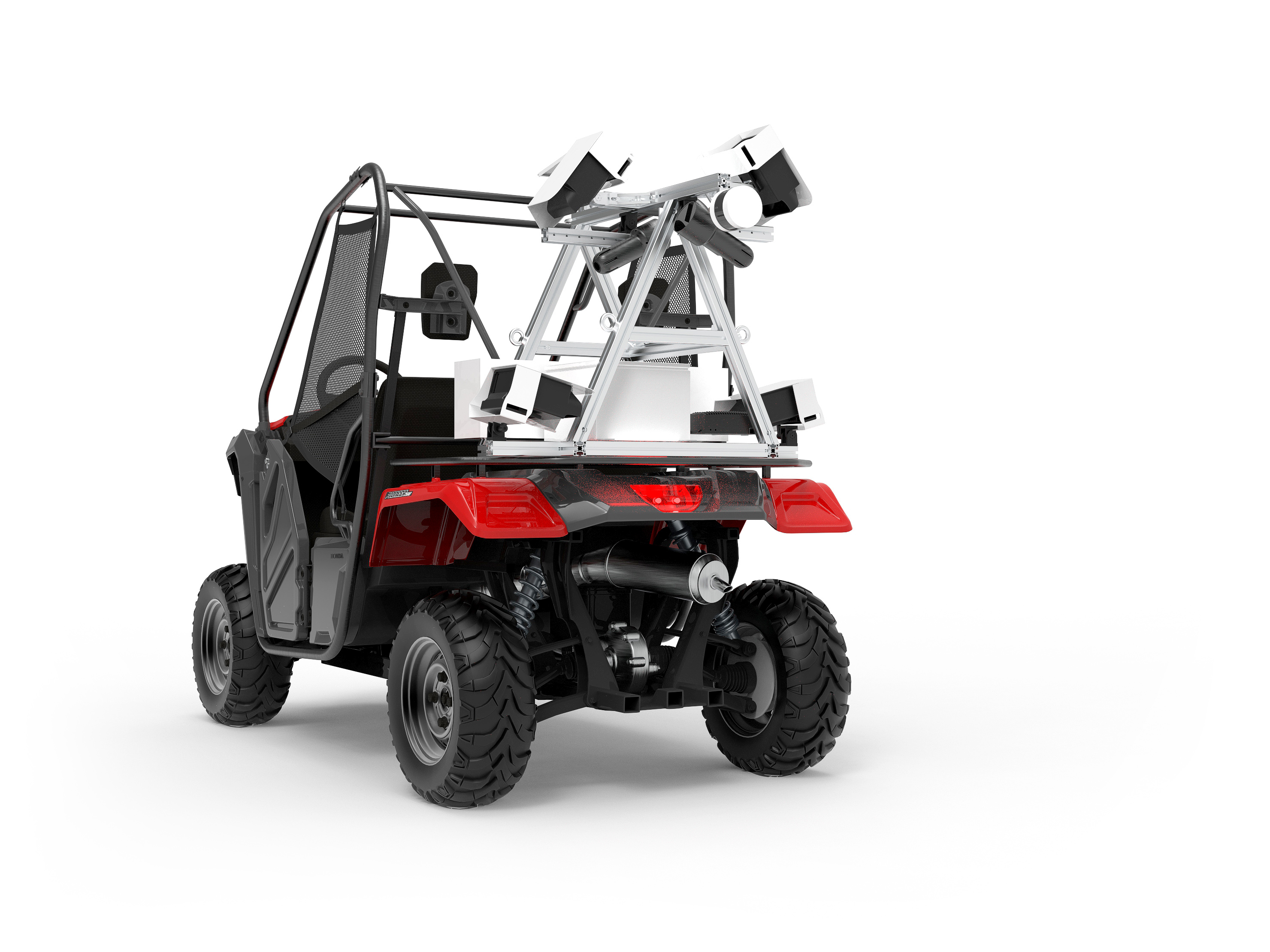
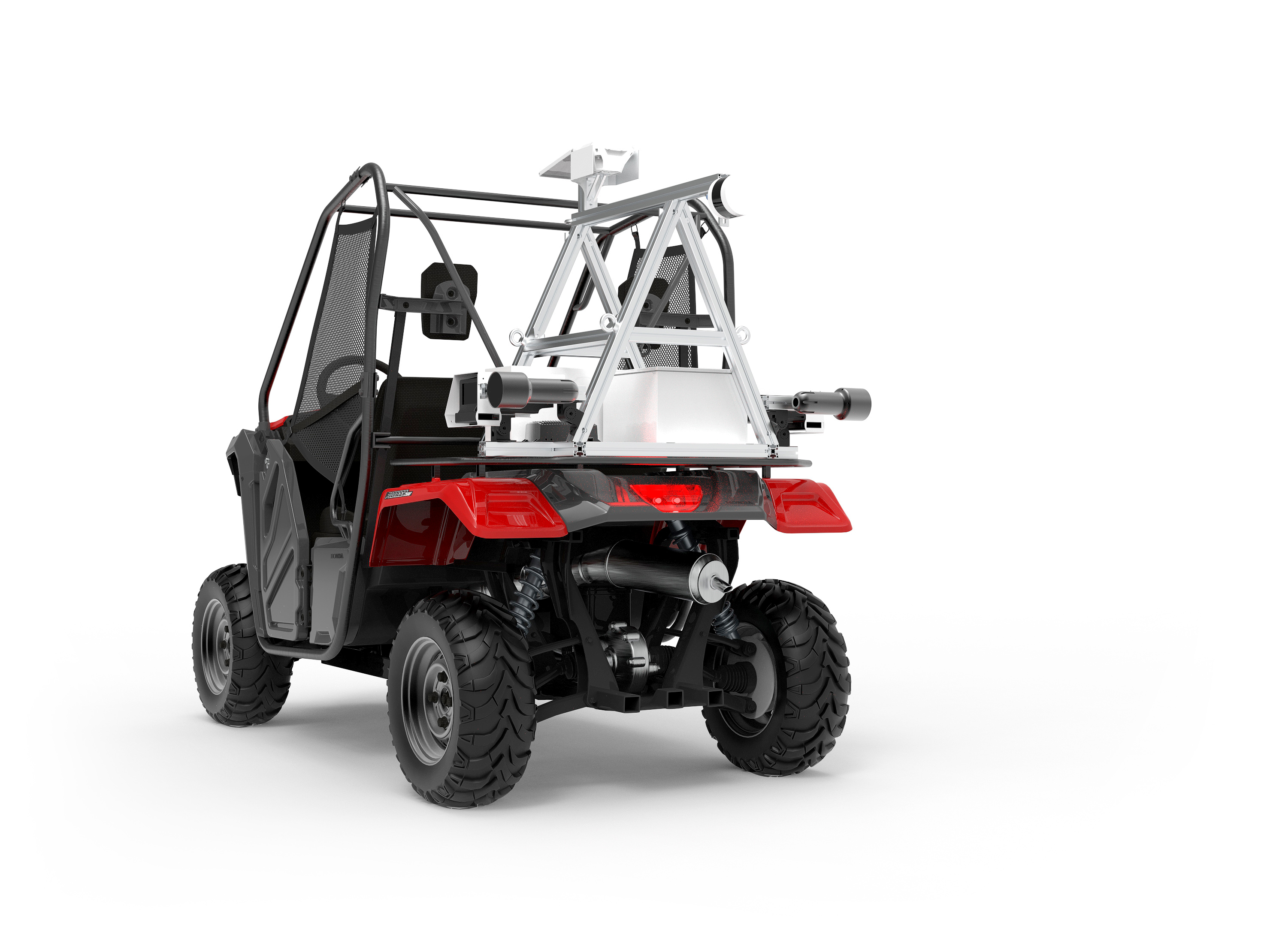
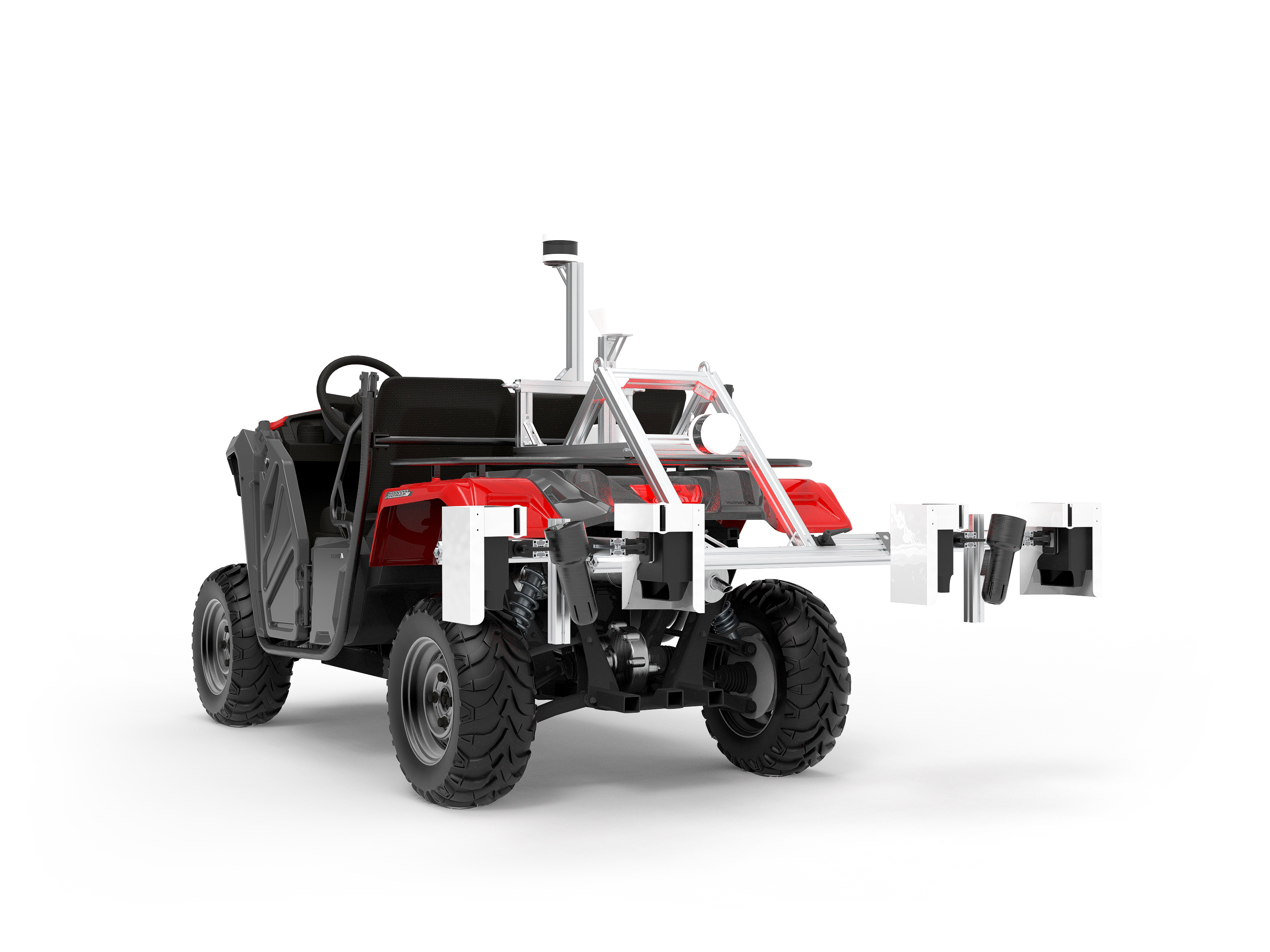
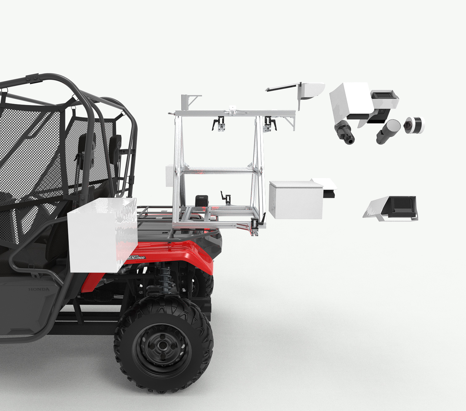
Thanks to our unique imaging technology, the Cartographer platform can be configured to fit a variety of base ATVs, and is suitable for not only a wide range of crops, but also varying row spacings, layouts and canopy geometries.
Cartographer Process
Easy as 1, 2, 3!
Capabilities
The Cartographer is designed to service a wide range of crops, with varying density, architectures, and phenology. Our capabilities are continuously evolving and currently we include a diverse set of valuable tools.
| Speed | 20km/h, 15mi/h |
|---|---|
| Coverage | 6 hectares/h, 15 acres/h |
Typical trellised orchard, Inter-row spacing: 4m, Imaging: Both sides
| Speed | 45km/h, 28mi/h |
|---|---|
| Coverage | 50 hectares/h, 120 acres/h |
Inter-row spacing: 7.25m, Imaging: Single side (eg mummified almond nuts for orchard sanitation activities)
| Battery life | > 10 hours |
|---|---|
| Data delivery | Typically available next morning |
| Formal 2D, 2 ½D training systems |
|---|
| 3D untrained trees of virtually any size |
| V-trellis |
| I-trellis |
Our custom processing system produces a range of outputs that can be delivered as required.
| An interactive web viewer |
| Raw data files for use in any compatible software or apps |
| GeoPDF for real-time, in-field location overlay on phones / tablets |
| Automated agronomic reports, also in GeoPDF format |
| Geographic Information System (GIS) integration |
| Zone maps to highlight areas of interest or concern. Upload directly into your variable rate equipment for automated spraying, spreading and pruning |
| Customised to suit your specific farm needs |
| Bud-sites and Bursting Bud Density Estimation |
| Flower Density Estimation |
| Fruitlet Density Estimation |
| Mature Fruit Density and Yield Estimation |
| Fruit Size Distribution |
| Tree Geometry Mapping |
| Leaf Area Mapping |
| Colour and Hue Mapping |
| Cluster Mapping |
| Variable Rate (Spray, Spreading, Pruning) |
| ... and many more! |
See a sample
Online demo
Green Atlas is proud to offer an online demonstration of real-world, typical sample data, showing the imaging and analysis capabilities of our Cartographer platform, with results that you can expect from your orchard.
Learn More
Please reach out to our nearest partner or schedule a call with us to organise delivery of Cartographer to your orchard.